

Watch: Track Storm Brian as it edges towards Kildare tonight
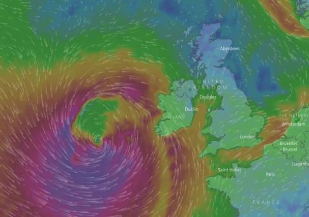

Some homes and businesses have yet to even get their power back following the huge winds of ex-Hurricane Ophelia on Monday, but another storm is moving Ireland's way and will bring gusts similar to what we faced at the start of the week.
Storm Brian is currently just a few hundred miles off the southwest coast of Ireland and is expected to make landfall by later on tonight, and it will be moving slowly towards Kildare in the early hours of the morning.
As can be seen from the excellent Windy.com graphic, the worst of the storm is due to arrive at around 11am tomorrow morning.
A Status Yellow Weather Warning has been issued for Kildare as gusts of up to 110kmh are expected to sweep across the county. Heavy flooding is also likely as downpours break out all over the country.
"Tomorrow the centre of the storm Brian will track into the Irish Sea with moderate winds for a time over Ulster and North Leinster but extremely windy elsewhere with storm force west to northwest winds along southwest coasts - especially during the morning," stated Met Eireann.
"Widespread heavy showers may merge into longer spells of rain with the risk of thundery downpours. Top temperatures of 10 to 13 degrees."